

Gisborne sits where three rivers meet the sea on New Zealand’s most easterly point, with steep, soft hill country rising immediately behind it. That geography gives the region its warmth, its wine and its surf — and its vulnerability.
The shape of the region
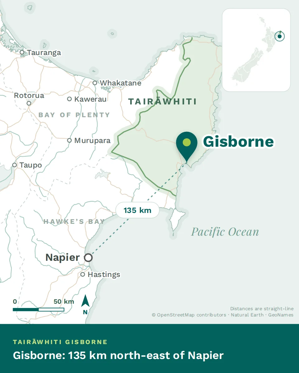
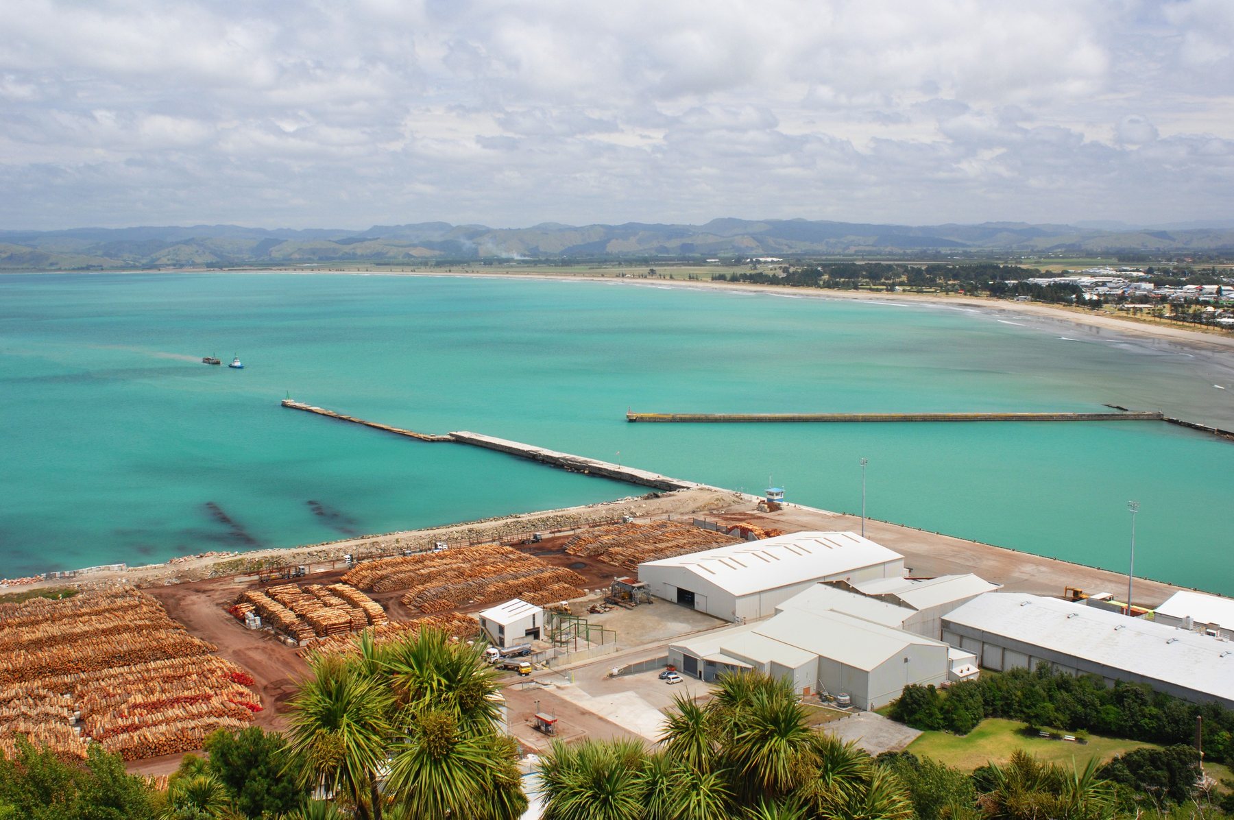
The city sits on the flats of Poverty Bay, where the Waimatā, Taruheru and Waipaoa rivers converge. Kaiti Hill rises above the harbour, and the surf beaches — Waikanae, Midway, Wainui and Makorori — run north along the coast from the city’s edge.
Behind the flats, the land climbs quickly into some of the steepest and most erosion-prone hill country in New Zealand: sheep and cattle stations, and extensive pine forestry. Inland and west lie the Raukūmara Range and Te Urewera, one of the largest tracts of native forest in the North Island.
North, the coast road runs to Tolaga Bay, Tokomaru Bay and Ruatōria, and eventually around the East Cape — a slow, beautiful, deeply Māori stretch of country. South, past the vineyards, the road runs to Māhia peninsula and on to Wairoa and Hawke’s Bay.
The four seasons
Indicative daytime highs on the flats. Inland and up the coast the hill country is cooler, and considerably wetter in a bad year.
What the numbers don’t tell you
It is warm, sunny and early. Around 2,200 hours of sunshine, hot dry summers, and mild winters. Being the most easterly city in the country means the sun arrives here first — and in midsummer that is very early indeed.
The hill country is soft, and that matters. The geology here is young and erodible, and much of the steep land was cleared for pasture and later planted in pine. When a big rain event arrives, the hills move. This is the mechanism behind the region’s flooding, its slips, and the forestry slash that ended up on beaches and bridges in 2023.
The roads are the region’s weak point. There are effectively two ways out by land — south to Wairoa, or north around the Cape — and both cross terrain that slips. Closures happen, and when they do, Gisborne is isolated.
Housing quality is variable. Prices are modest, but a good proportion of the stock is older and under-insulated. Ask about insulation, ventilation and heating, and check the Healthy Homes compliance statement — a legal requirement, covered in the national Renting in New Zealand chapter.
- In February 2023 Cyclone Gabrielle hit Tairāwhiti as hard as anywhere in New Zealand. Rivers broke out, bridges and roads were destroyed, forestry slash and silt buried farmland and beaches, and coastal communities north of the city were cut off for extended periods. Lives were lost across the affected regions.
- Where things stand now: the city functions normally. Much of the road network has been repaired or rerouted, but work continues, and some communities up the coast and inland are still rebuilding. Land use, forestry practice and river management remain live regional debates.
- Why it matters clinically: it left a lasting imprint on rural mental health, on how services plan for isolation and access, and on trust between communities and institutions. Colleagues here lived through it. Arrive informed rather than curious.
Where things are, in driving time
Words you’ll hear
Warm, sunny and early, on soft steep country with a fragile road network. The climate and the surf are why people come; isolation and erosion are the costs, and Gabrielle made both concrete. Healthcare here is the chapter that decides it.