
Northland is one long peninsula with two completely different coasts. Understanding that — and the single road that runs down the middle — tells you most of what you need about living here.
The shape of the place
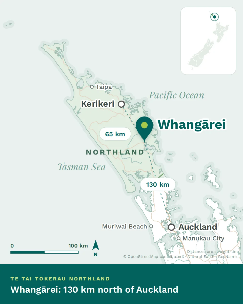
Three hundred kilometres from Auckland’s northern boundary to Cape Rēinga, and rarely more than eighty wide. State Highway 1 runs the length of it, and almost everything hangs off that spine.
The east coast faces the Pacific: sheltered, island-scattered, warm and calm, with the Bay of Islands at its centre. This is the postcard Northland and where most of the population lives. The west coast faces the Tasman: wild, exposed, black-sand, with the Hokianga harbour and the great kauri forests behind it. Fewer people, harder beauty.
Whāngārei sits on the east coast about two hours north of Auckland, wrapped around a harbour, and is the only place in the region with city-scale services. North of it, Kerikeri and Paihia in the Bay of Islands; further north, Kaitaia and the Far North. West and south, Dargaville and the Kaipara.
The four parts of the region
Subtropical, and what that means
Northland has the warmest, most humid climate in New Zealand. Two seasons dominate: a long warm summer and a mild wet winter. Spring and autumn are both pleasant and short.
- Humidity is the housing issue here. Mould, condensation and musty cupboards are the common complaints, and they affect health — particularly for children with asthma.
- What matters in a house: ventilation, extractor fans in the kitchen and bathroom, a dehumidifier, and insulation that is dry. Heating matters far less than it does in the South Island.
- When you view a rental, look for mould around window frames and in wardrobes, and ask what ventilation there is. Landlords must meet the Healthy Homes standards, which include ventilation — see Renting in New Zealand.
Where New Zealand’s story begins
This is not decoration — it shapes how healthcare is practised here. The Bay of Islands is where Māori and Europeans first sustained contact, where the first mission stations were established, and where Te Tiriti o Waitangi was signed in 1840.
Around a third of Northlanders identify as Māori, the highest of any region, and iwi and hapū are significant providers and partners in health services. You will encounter te ao Māori in clinical practice here more directly and more often than anywhere else in the country — karakia, whanaungatanga, working with whānau rather than individuals, and services delivered by Māori health providers.
Clinicians who engage with that find it the most rewarding part of practising in Northland. It is worth arriving prepared to learn.
Getting out
Whāngārei and Kerikeri both have small airports with connections to Auckland. Everything else goes by road: two and a quarter hours to central Auckland from Whāngārei, closer to four from Kaitaia. Auckland Airport, and therefore every international flight, is a further hour beyond the city.
Practically: a trip home to Europe or Africa is a long day before you even board. Plan for it, and budget for the Auckland leg.
- Two coasts that feel like different countries — sheltered and populated in the east, wild and quiet in the west.
- Subtropical means damp, not cold. Ventilation matters more than heating when you choose a house.
- Te ao Māori is central to healthcare here in a way it isn’t elsewhere. Arrive ready to learn.