
A wide bay open to the Pacific, a fertile alluvial plain behind it, and ranges beyond that which strip the westerly of its rain. That geography gives Hawke’s Bay its sunshine, its wine and its drought — and, occasionally, its floods.
The shape of the region
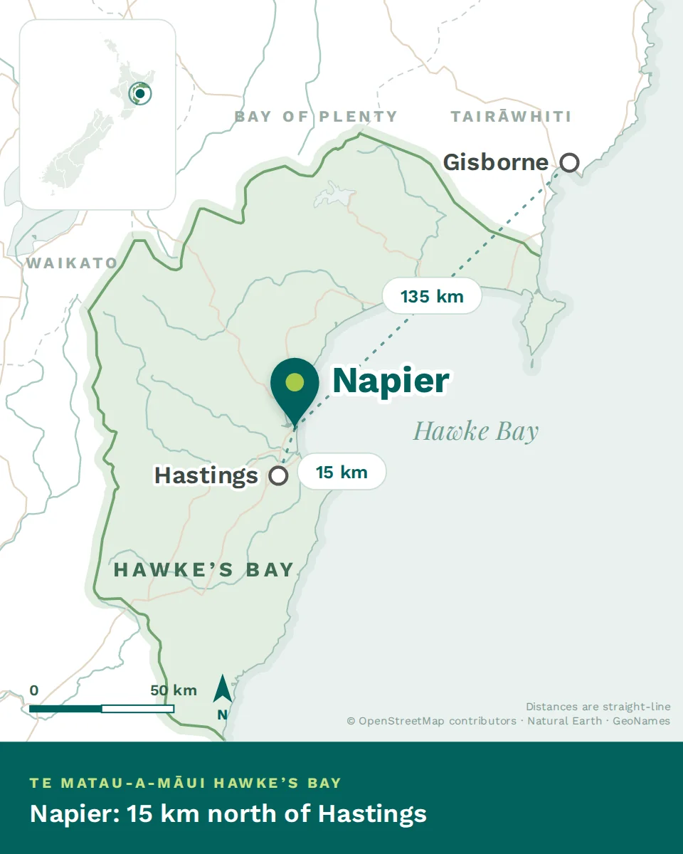
Napier sits at the northern end of the bay on a low hill that was an island until the 1931 earthquake lifted the seabed around it. South across the flat Heretaunga plain lies Hastings, with Havelock North tucked beneath Te Mata Peak between them. The plain is the productive heart: orchards, vineyards and market gardens on some of the best soil in the country.
West, the land rises through hill-country sheep and cattle stations to the Kaweka and Ruahine ranges — the barrier that makes this coast dry. North, the road climbs past the Esk Valley towards Wairoa and eventually the East Cape. South, the coast runs past Cape Kidnappers and its gannet colony into Central Hawke’s Bay, the small towns of Waipawa and Waipukurau, and eventually the Wairarapa.
The four seasons
Indicative daytime highs on the plain. Inland and in the hill country, winters are colder and frosts are routine.
What the numbers don’t tell you
This is the closest the North Island comes to a Mediterranean climate. Somewhere above 2,200 sunshine hours a year, hot dry summers, and mild winters on the coast. It is why the wine ripens the way it does, and why the fruit is what it is. If you have come from northern Europe, the number of usable outdoor days here will change your year.
Drought is a real feature, not a rare event. The ranges take the rain and the plain can go a long time without it. Water restrictions in summer are normal, and dry years are hard on the rural economy in a way that reaches into the clinic.
The east coast is exposed to weather from the tropics. Ex-tropical systems track down onto this coast, and when they arrive they can bring extraordinary amounts of rain in a short time onto steep hill country. That is the mechanism behind the region’s flood history.
Houses need cooling as much as heating. Unusual for New Zealand. Summer heat on the plain is significant, so shade, insulation and a heat pump that works both ways all matter. Still check the Healthy Homes compliance statement, which is a legal requirement and covered in the national Renting in New Zealand chapter.
- In February 2023 Cyclone Gabrielle brought catastrophic rain to Hawke’s Bay. Rivers broke their banks, valleys flooded, roads and bridges were destroyed, thousands of people were displaced and lives were lost. It was the most damaging weather event in the region’s modern history.
- Where things stand now: Napier and Hastings functioned throughout and are fully operating. Recovery in the worst-hit areas — the Esk and Tūtaekurī valleys, parts of the Ngāruroro catchment, and the road north to Wairoa — has been long, and some of it continues. Significant work on stopbanks, roads and land-use planning is under way.
- Why it matters clinically: it left a lasting imprint on rural mental health, on how services plan for isolation and access, and on the region’s whole conversation about resilience. Colleagues here lived through it. It is worth arriving informed rather than asking about it as trivia.
Where things are, in driving time
Words you’ll hear
A sunny, dry, fertile east-coast region with two cities twenty minutes apart and hill country behind. The climate is the reason people come; drought and exposure to tropical weather are the costs. The first real decision is Napier or Hastings — Where clinicians live is next.